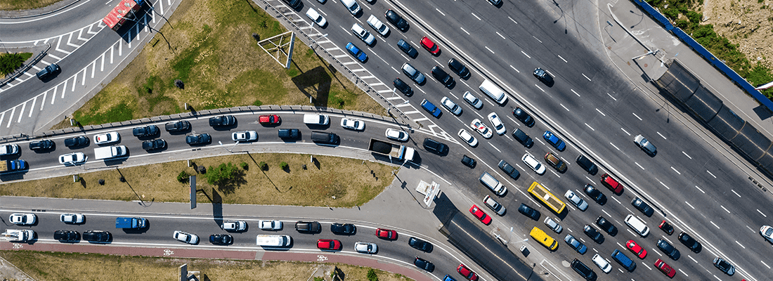
For the first time, a drone has been used to do a traffic analysis in Brussels, last week. During the morning rush, the drone flew above the busiest traffic junctions of the Belgium capital. This analysis will be used to redesign the square to improve traffic congestion.
By using the drone, all passing traffic was visualized and it was easy to see how the flow was progressing. The drone was flying two hours at a height of 75 meters.
“Normally this is done by observers and cameras, but using a drone and seeing everything from a helicopter view, it is much quicker.” According to the Mobility Minister of Brussels, Pascal Smet.
A tethered drone from DroneMatrix was used to get an overview of the traffic challenges. By use of a power cable to the ground station, the drone can stay in the air for hours without interruption.
The idea is to also use the drone to analyze other challenging traffic places.
If this project shows useful results, the drone will also be used at other challenging traffic nodes.
Read the Dutch article here.


